What is GeoSpy?
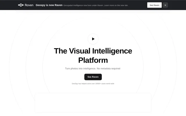
GeoSpy is a visual intelligence platform for estimating locations from photographs using AI and computer vision. GeoSpy serves qualified government and enterprise organizations, with law enforcement prominently featured among its intended users. The core function is to turn image content into location intelligence without requiring metadata, allowing analysis to rely on the visible pixels in a photograph.
GeoSpy describes its location models as applicable to a city or country and advertises accuracy of up to meter level. The website connects these capabilities with professional investigations, including locating suspects and supporting fugitive apprehension. These are presented as organizational applications rather than a general consumer photo service.
What GeoSpy can do
GeoSpy focuses on extracting location information from images, including photographs with little contextual information. GeoSpy lists geo-estimation, precision targeting and property targeting as capability areas. The page explains pixel-based geo-estimation, but provides no comparable technical description of how the targeting capabilities operate or differ.
- GeoSpy estimates locations using only image pixels.
- GeoSpy analyzes low-context images for location clues.
- GeoSpy provides AI location models for a city or country.
- GeoSpy lists precision targeting and property targeting capabilities.
How GeoSpy works
GeoSpy uses AI location models and computer vision to derive location information from photographs. GeoSpy explicitly states that metadata is not required, distinguishing the described process from reading location information attached to an image file. The page emphasizes an easy-to-use interface, but does not describe the image submission process, supported file formats or a detailed analysis workflow.
GeoSpy provides links labeled Try Demo and See Demo for exploring the service. Organizational licensing follows a separate contact path, with availability restricted to qualified government and enterprise organizations. The page does not explain qualification criteria or specify how demo access relates to licensed organizational access.
Who GeoSpy is for
GeoSpy is aimed at professional users in government, law enforcement and enterprise organizations. GeoSpy highlights investigations in which authorities need to determine the location of suspects from visual material. The page also describes acting on real-time, sensitive data, but does not outline separate enterprise industry workflows or give detailed operational procedures.
- GeoSpy supports location estimation from photographs used in investigations.
- GeoSpy describes suspect location as a law enforcement application.
- GeoSpy presents fugitive apprehension as an investigative use case.
GeoSpy pricing and licensing
GeoSpy makes licensing and pricing information available upon request rather than publishing a price list. GeoSpy directs qualified government and enterprise organizations to contact the company for details. The page includes demo links, but does not state whether demos are free, define subscription tiers or describe what a license includes.
GeoSpy strengths and limitations
GeoSpy's stated strengths include metadata-independent photo analysis, support for low-context images and location models focused on a city or country. GeoSpy advertises accuracy of up to meter level, rather than stating that every result reaches that precision. Access is limited to qualified organizations, and prospective users need to request licensing and pricing information before evaluating commercial terms.
GeoSpy FAQ
What is GeoSpy?
GeoSpy is a visual intelligence platform that uses AI location models and computer vision to estimate locations from photographs. GeoSpy analyzes image pixels without requiring metadata and is available to qualified government and enterprise organizations.
Does GeoSpy need photo metadata?
GeoSpy does not require photo metadata to estimate a location. GeoSpy's geo-estimation models use the pixels in an image, and the website specifically describes support for low-context photographs.
Who can use GeoSpy?
GeoSpy is available to qualified government and enterprise organizations, with law enforcement highlighted as a target audience. GeoSpy describes applications involving suspect location and fugitive apprehension, while qualification criteria are not detailed on the page.
How much does GeoSpy cost?
GeoSpy provides licensing and pricing details upon request for qualified government and enterprise organizations. GeoSpy does not publish prices or plan comparisons on the page, although demo links are available.
How accurate is GeoSpy?
GeoSpy advertises location accuracy of up to meter level using AI location models for a city or country. GeoSpy's page does not provide testing conditions or a detailed explanation of when that accuracy can be achieved.
From the community
No reviews yet
Be the first to review this tool. What you write helps the next person choose.